


Introduction
Geographic Information Systems (GIS) have become indispensable tools for mapping, spatial analysis and location-based tasks. Whether used by governments, field teams, developers or researchers, GIS software provides critical capabilities for visualizing, analyzing and interpreting geo-spatial data. With constantly evolving needs, it’s important to understand the range of GIS options available and identify the best fit for an organization’s specific budget and requirements. In this post, we review 15 leading GIS platforms based on key criteria to help select the most feature-rich and versatile solution.
Methods of Evaluation
Each GIS software is evaluated based on factors like available features, customization options, integration support, pricing structures, technical documentation and community support. Beyond traditional criteria, we also consider modern metrics like number of backlinks, average monthly traffic and keyword search trends to gauge real-world adoption and popularity over time. This helps identify options with strong networking effects and positions them as potentially better long term choices.
1. OpenStreetMap
OpenStreetMap is a free and editable map of the world built by volunteers. Founded in 2004, OSM allows users to freely add and edit map data. The project aims to create a map of the world and share the data freely. OSM serves as a foundational map for many commercial applications and is viewed by millions every day.
Pros: Some key advantages of OpenStreetMap include:
– Free to use and open data – map data and software code is freely available under an open license
– Customizable – users can freely add and edit data to meet their needs
– Constantly updated – new map details and locations are added daily by volunteers
– Highly accurate in many regions – volunteers have mapped in great detail
Cons: A potential disadvantage is that coverage and accuracy can vary significantly depending on the region. Areas that have not been mapped or updated by volunteers may lack detail or contain errors compared to commercial alternatives.
Pricing: OpenStreetMap is completely free to use with no pricing or fees. Users can freely download map data in common formats or use the data via public APIs at no cost. There are no premium paid features or plans.
Some key stats about OpenStreetMap include:
– Over 4 million registered users contributing to the map
– Over 2.5 billion geographic edits made to date
– Map data available for download in common formats like Shapefiles and GeoJSON
– Serves as a foundational basemap used by many commercial applications
OpenStreetMapOpenStreetMap is the free wiki world map.openstreetmap.org![]()
2. Esri
Esri is the global market leader in GIS software. Founded in 1969, Esri software is used by over 350,000 organizations worldwide including government agencies, non-profits, and Fortune 500 companies. Esri was named one of America’s ‘Most Jurisdictional Companies’ by Forbes in 2022.
Pros: Key advantages of Esri’s GIS software include:
– Widely used GIS software with powerful mapping and spatial analysis capabilities
– Large ecosystem of apps, extensions and developer tools
– Continuous updates and new product releases
Cons: The main disadvantage is the higher upfront and ongoing licensing costs compared to some open source GIS alternatives.
Pricing: Esri offers both perpetual and subscription licensing options. Pricing depends on the number of users and features/applications needed. Contact Esri sales for a customized quote.
Some key stats about Esri include:
– Over 350,000 organizations use Esri GIS software worldwide
– Used by over 95% of federal agencies in the US
– Esri software powers over 15,000 public safety, emergency response, and transportation agencies worldwide

3. Mapbox
Mapbox is a leading geographic information system (GIS) software company that provides location data, mapping tools, and SDKs for developers to build location-aware applications. Founded in 2010, Mapbox is based in San Francisco and powers maps for major tech companies like Facebook, Uber, and The New York Times. Their mission is to solve the hardest problems in mapping and location-based services so engineers can focus on their core product.
Pros: Some key advantages of Mapbox include:
– Customizable map tiles and styles that can be fully branded to a company or application
– Deep integration with popular mobile and web frameworks out of the box
– Ability to host custom vector data and styles on their platform
– Advanced location APIs and SDKs for tasks like search, routing, geocoding, etc.
Cons: One potential disadvantage is that Mapbox’s free tier has usage limits, so applications with high volume needs may need to upgrade to a paid plan.
Pricing: Mapbox offers both free and paid plans. The free tier includes 25,000 free map views per month. Paid plans start at $7/month for 25,000 credits and scale up based on usage and custom data hosting needs.
Some key stats about Mapbox include:
– Used by over 3 million developers globally
– Processed over 15 trillion map tiles in 2021
– Supports over 50 programming languages and frameworks like Flutter, React Native, Swift, and more
– Serves map tile data to over 200 billion devices per year

4. MicroStation
MicroStation is a computer-aided design (CAD) and engineering software developed and sold by Bentley Systems. First released in 1984, MicroStation is a mature CAD platform that has been used heavily for infrastructure and utilities projects. It provides extensive GIS capabilities and tools for integrating design and geospatial workflows.
Pros: Some key advantages of MicroStation include:
– Mature and reliable platform optimized for infrastructure and engineering design workflows.
– Seamless integration of CAD data like geometries with GIS data like imagery and geospatial databases.
– Robust set of tools for 3D design, analysis, visualization, and construction modeling.
– Flexible licensing options including perpetual and subscription-based.
Cons: One potential disadvantage is that MicroStation tends to have a steeper learning curve compared to some other CAD software given its long history and extensive capabilities. It may require more time and training for new users to become proficient.
Pricing: MicroStation is available through flexible licensing options including perpetual licenses purchased outright and term-based subscription plans. Subscription pricing starts at approximately $100-200 per user per month depending on the selected plan and number of users.
Some key stats about MicroStation include:
– Has been on the market for over 35 years and is used by over 90% of transportation agencies in the US.
– Is used for a wide range of large-scale civil engineering, construction, and geospatial projects including roads, railways, bridges, utilities, and more.
– Supports the management of 3D geospatial information and has robust 3D modeling, analysis, and visualization tools.
– Has a user base of over 500,000 architectural, engineering, construction, and geospatial professionals worldwide.
5. BAE LOCATION INTELLIGENCE
BAE Location Intelligence is a geographic information system (GIS) software developed by BAE Systems for defense, intelligence, and security organizations. The software provides specialized mapping, analytics, and geospatial technologies to support critical missions.
Pros: Some key advantages of BAE Location Intelligence include:
– GIS solutions purpose-built for defense and security organizations with specialized mapping and analytic functions
– Analytics tailored for critical applications like intelligence analysis, infrastructure protection, and tactical mission planning
– Highest levels of data security with compliant hosting of classified geospatial data and role-based access controls
Cons: A potential disadvantage is the software is focused mainly on defense, intelligence, and government users rather than broader commercial markets.
Pricing: BAE Location Intelligence pricing is custom-quoted based on configuration, licensing needs, and level of support required. As a defense contractor solution, it aimed at enterprise government customers rather than individual or SMB users.
Some key stats about BAE Location Intelligence include:
– Used by over 50 defense agencies and intelligence organizations worldwide
– Supports over 100 specialized geospatial data layers and formats
– Secure hosting and processing of classified geospatial data in accredited data centers
– Advanced analytics for pattern of life analysis, threat assessment, and resource allocation

6. Carto
Carto is a leading geographic information system (GIS) software company that provides a cloud-based platform for location intelligence and geospatial analytics. Founded in 2010 and headquartered in Madrid, Spain, Carto’s mission is to make location data accessible and meaningful for everyone through their web-based platform.
Pros: Some of the key advantages of Carto’s platform include:
– It is cloud-based which allows users to access maps and perform analyses from any internet-connected device without installing any software.
– Their drag-and-drop interface makes it very easy to visualize, analyze and share location-based data.
– It is cost-effective compared to traditional desktop GIS software with flexible pricing based on data and user volumes.
Cons: One potential disadvantage is that as a cloud-based platform, users don’t have control over the underlying infrastructure and rely on Carto’s servers and services being up and running.
Pricing: Carto offers several paid plans starting from a Starter plan at $29/month for up to 3 users and 1GB of map tiles. Their Grow plan costs $99/month and supports up to 10 users and 5GB of tiles. Carto also offers custom enterprise plans for larger organizations.
Some key stats and facts about Carto include:
– Used by over 10,000 organizations including governments, non-profits, and enterprises.
– Processes over 1 billion map views per month on its platform.
– Employs over 200 people globally.
– Raised over $100 million in funding to date.

7. Leaflet
Leaflet is an open-source JavaScript library for mobile-friendly interactive maps. The library is maintained by Anthropic and is free to use under a BSD 2-clause “Simplified” License. It supports GPS-based geolocation, vector shapes like circles and polygons, popups and tooltips, advanced events, animations and more. Leaflet maps can be easily customized with plugins and CSS styling.
Pros: Some key advantages of Leaflet include:
– Open source and free to use commercial purposes
– Lightweight and fast loading for responsive and mobile maps
– Highly customizable through plugins and CSS theming
– Support for GPS-based geolocation and vector shapes
– Advanced events, animations and popups/tooltips integration
Cons: One potential disadvantage is that Leaflet is focused purely on mapping and visualization. More fully-featured GIS systems provide additional geospatial analysis, data management and reporting features out of the box.
Pricing: Leaflet is completely open source and free to use. There are no licensing fees or restrictions on commercial use. Developers are encouraged to support the project through donations on their website.
Some key stats about Leaflet include:
– 10 million+ monthly downloads from CDN providers
– Used on over 300,000 websites
– Over 1,000 plugins available to extend its capabilities
– Lightweight at just under 40kB min+gzip
– Actively maintained with latest release in January 2023
8. FME
FME is a leading data integration platform developed by SAFE Software that allows users to transform data between hundreds of different file formats. As one of the most popular geographic information system (GIS) software tools, FME empowers organizations to easily convert, clean and move geospatial and asset data to drive better decision making.
Pros: Some key advantages of FME include:
– Universal data integration – Moves data effortlessly between virtually any format or system
– Insightful transformations – Perform complex data transformations and analysis during integration
– Extensive format support – Supports hundreds of vector, raster and point cloud formats natively
– Robust scheduling – Automate recurring integrations through FME Server integration scheduling
Cons: The main disadvantage of FME is that the learning curve can be steep initially for complex workflows or transformations. Getting started is easy, but mastering advanced functions takes time and effort.
Pricing: FME is available through perpetual or annual subscriptions. Perpetual licenses for desktop software range from $1,500 to $6,000 depending on the edition. Server software subscriptions start at $6,000 per year. Discounts are available for academic users and large volume deployments. A free 30-day trial is available to test FME functionality.
Some key stats about FME include:
– Used by over 30,000 companies and public sector organizations worldwide
– Supports over 300 different data formats out of the box including ESRI, AUTOCAD, Excel, GML and many more
– Supports all major operating systems including Windows, Linux and macOS
– Home to one of the largest GIS communities with over 110,000 annual user conference attendees

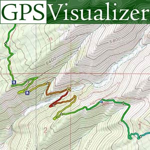
9. GPS Visualizer
GPS Visualizer is a free online mapping tool that allows users to import, visualize and analyze GPS data. Founded in 2009, GPS Visualizer has grown to be one of the most popular mapping utilities for GPS data.
Pros: Some key advantages of GPS Visualizer include:
– Browser-based so no need to download software
– Imports GPS files from devices and smartphones
– Integration with OpenStreetMap allows custom maptiles
– Basic functions like visualization are free to use
– Useful tools for analyzing and measuring GPS data
Cons: The main disadvantage is that some advanced processing and exporting options require a paid subscription. The free version limits exports and downloads.
Pricing: GPS Visualizer offers both free and paid plans. The free basic plan allows visualization and basic measurements. For $9.95/month or $54.95/year, the premium plan unlocks exports, advanced tools and larger file processing capabilities.
Some key stats about GPS Visualizer include:
– Used by over 5 million users annually
– Supports over 30 different GPS file formats for import
– Offers measurement tools like distance, bearing and grid references
– Allows adding waypoints, routes and tracks directly on the map
– Maps are customizable with layers and styling options
10. ENVI
ENVI is a leading geographic information system (GIS) software for remote sensing image analysis developed by Harris Geospatial Solutions. ENVI provides workflows and tools for processing, analyzing, and visualizing geospatial imagery and remote sensing data.
Pros: Some key advantages of ENVI include:
– Leading remote sensing software for over 30 years, regarded as the industry standard.
– Provides complete workflows from data input to imagery analysis to visualization and output.
– Tight integration with ArcGIS allows working with remote sensing and GIS data in a common platform.
Cons: One potential disadvantage is that ENVI is primarily focused on raster data analysis and may not meet the needs of users requiring advanced vector data processing capabilities.
Pricing: Pricing for ENVI software varies based on the specific modules and team size needed. Contact Harris Geospatial for a customized quote. Academic/non-profit licenses are also available at discounted rates.
Some key facts about ENVI include:
– Used by over 10,000 organizations worldwide including government agencies, commercial companies, and academic institutions.
– Integrates tightly with Esri’s ArcGIS platform allowing seamless data processing and analysis.
– Offers pre-built modules and analytics tools for applications like land use/land cover classification, change detection, vegetation analysis and more.

11. Atlas.ti
Atlas.ti is a qualitative data analysis software developed and published by ATLAS.ti GmbH. It is one of the leading qualitative data analysis software used globally by researchers, academia, and industry. Atlas.ti helps users manage, organize, code and analyze various qualitative data like interviews, focus groups, surveys, transcripts, videos, social media etc.
Pros: Some key advantages of Atlas.ti include:
– Powerful yet easy to use interface for qualitative coding and analysis.
– Spatial tools help analyze qualitative data in the context of locations.
– Allows collaborative analysis through team features and online Atlas.ti Cloud.
– Wide file format support to import various types of multimedia data.
– Regular updates and improvements to features based on user feedback.
– Free trials and affordable pricing plans for students, academics and organizations.
Cons: One potential disadvantage could be the learning curve for some of the advanced analysis features. As with any qualitative analysis software, it may take some time to get familiar with the interface and various tools.
Pricing: Atlas.ti offers the following pricing plans:
– Individual license starts at $99 per month or $990 annually.
– Team licenses start at $199 per month for 2 users or $1990 annually.
– Academic pricing and discounted plans are available for students and educational institutions.
– Free trials are available to test the software before purchase.
Some key features and stats of Atlas.ti include:
– Used by over 4 million researchers, academics and organizations worldwide.
– Supports over 40 file formats for import and analysis.
– Allows visualization and analysis of relationships between codes and concepts.
– Integrates GIS mapping capabilities for spatial analysis of qualitative data.
– Available on Windows, Mac and Linux operating systems.

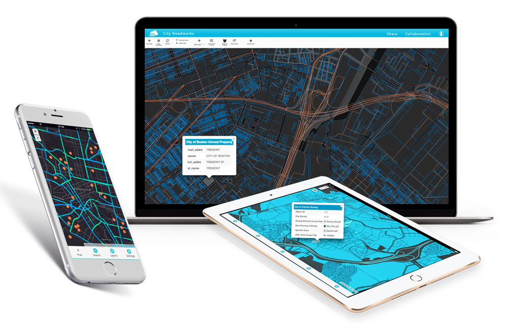
12. GISCloud
GISCloud is a cloud-based geographic information system (GIS) software created by GISCloud Inc. It provides field data collection, operations management, and collaboration capabilities through a real-time mapping platform designed to work both online and offline across web and mobile apps.
Pros: Some key advantages of GISCloud include:
– Cloud-native platform making it optimized for web and mobile deployments.
– Focuses heavily on ease of use and intuitive interfaces.
– Popular free tier option makes it very accessible for newcomers to try out.
Cons: One potential disadvantage is that as a cloud-based platform, it requires an internet connection to access maps and leverage full functionality. This could be an issue for some field workers in remote locations with unreliable internet.
Pricing: GISCloud offers both free and paid subscription plans. The free forever tier supports up to 3 users and has basic data and app limitations. Paid plans start at $29/month per user for the Basic plan and scale up to enterprise-grade premium subscriptions with unlimited users and advanced capabilities.
Some key stats about GISCloud include:
– Used by over 5,000 organizations globally across various industries like utilities, transportation, and government.
– Supports over 50 different data formats for easy import and export of geospatial data.
– Available on both free and paid subscription tiers with the free tier allowing for lightweight usage.
13. CarteGraph
Cartegraph is a leading provider of geographic information system (GIS) and asset management software for government agencies and organizations. Founded in 1993, Cartegraph provides a comprehensive SaaS platform to manage infrastructure, assets, and work across public works departments including transportation, utilities, and facilities. With over 1,000 government customers, Cartegraph helps optimize asset performance and maintenance operations.
Pros: Key advantages of the Cartegraph software include:
– Asset management software for facilities, fleet, linear and other infrastructure assets
– Integrates maintenance, budgeting and capital planning workflows
– Mobile access allows updating of asset and work order information from the field
– Robust reporting and analytics on asset performance, work productivity and resource allocation
– Highly configurable to support varying needs of government organizations and departments
Cons: A potential disadvantage is that the product is primarily designed for and implemented within government agencies. As such, the software may not be as suitable for private sector or non-governmental organizations that have different operational needs and requirements.
Pricing: Pricing for Cartegraph is typically quoted on an annual subscription basis depending on the number of users, assets managed and additional modules implemented. Featured plans start at $40,000 per year for basic asset management up to $150,000+ per year for enterprise-wide implementations with advanced analytics, mobile access and unlimited user licenses.
Some key stats about Cartegraph include:
– Over 1,000 government customers across North America
– Integrations available with ArcGIS and other major systems
– Mobile accessibility for field crews and inspections
– Configurable to meet unique needs of cities, counties, states and other agencies

14. Skyline
Skyline is a leading provider of geographic information system (GIS) and 3D modeling software. Founded in 1999 and headquartered in Ottawa, Canada, Skyline helps organizations worldwide manage city infrastructure and optimize planning processes. Some key industries Skyline serves include urban planning, engineering & construction, telecommunications, renewables, and environmental management.
Pros: Some key advantages of Skyline software include its capabilities for GIS and 3D modeling, tools for urban planning and analysis, integration of vector and 3D data formats, intuitive user interface and customizable workflows.
Cons: As an on-premise software solution, Skyline requires IT resources for installation, maintenance and system administration. The pricing can also be higher compared to some cloud-based or open-source GIS alternatives.
Pricing: Skyline offers flexible pricing models including annual subscriptions and perpetual licenses. Pricing varies based on the selected modules, number of users and type of deployment (desktop vs server). Contact Skyline sales for a customized quote.
Skyline software powers over 500 cities globally. Key features include integrated 3D and vector data modeling, photorealistic visualizations, simulation and analysis tools. It provides a comprehensive digital twin solution for visualizing, analyzing and collaborating on urban planning projects.

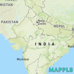
15. Mappls
Mappls is an Indian mapping and location platform that provides geographic information system (GIS) solutions. Founded in 2012, Mappls powers navigation, tracking, and mapping services for both consumer and enterprise applications. With robust APIs, SDKs and integrated solutions, Mappls aims to solve geospatial challenges across various industries.
Pros: Key advantages of using Mappls include:
– It is an Indian mapping platform with a large domestic user base
– Offers specialized APIs and SDKs for building location-based apps and services
– Provides vast libraries of Indian spatial content like vector maps, traffic, places etc.
Cons: One potential disadvantage is that Mappls’s focus is mainly on the Indian market and it may not have as comprehensive global coverage compared to other GIS providers.
Pricing: Mappls offers both free and paid tiers for its APIs and solutions. The free tier includes basic maps and navigation APIs while advanced features like real-time traffic, fleet management etc. require a paid subscription starting from $20-$500 per month based on features and usage.
Some key stats about Mappls include:
– Over 100 million users in India
– Coverage of 10 million km of roads and streets
– Supports 25+ Indian languages
– Partners with major automotive, logistics and delivery companies in India
Conclusion
While all the evaluated GIS software offer valuable mapping capabilities, their strengths differ based on usage scenarios. Commercial platforms like Esri and Bentley offer the most robust out-of-the-box functionality but may have higher costs. Open-source options like OpenStreetMap and Leaflet are very flexible but require more do-it-yourself integration. Cloud-based SaaS providers deliver quick time-to-value through their pre-built apps and interface. The right choice ultimately depends on an organization’sspecific mapping and analysis needs, technical skills, budget and timelines.